Where is Gellhorn in GTA 6?
Rockstar Games' official map of Leonida prints Gellhorn in grid square F4. Measured on the map, its label is north of the Burial Creek label, and the nearest county label is South Kelly County, to the southeast.
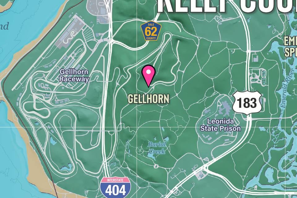
- Type
- Area
- Grid square
- F4
- Nearest county label
- South Kelly County, to the southeast
- Map published
- November 19, 2026
Grid squares are the letters (rows) and numbers (columns) printed around the edge of Rockstar's map. The map prints county names but no county borders, so this page gives the nearest county label, not a county.
On the interactive map you can mark Gellhorn found. Free: 10 places marked found and 3 markers of your own. PRO ($4.99 once) makes both unlimited.
Nearest printed places
Measured between the labels on Rockstar's map, where north is up
More area labels on the map
Nearest first
Sources
- Rockstar Games: Grand Theft Auto VI: rockstargames.com/VI
Rockstar Games published the map on November 19, 2026; every position and direction here is measured on it. Leonida Map is unofficial: every fact and quote on this page comes from the pages above. Spot a mistake? Tell us.